")
- Editorial:
- ITMB
- Año de edición:
- 2023
- Materia:
- Alps. mapes viatge
- Idioma:
- English
- ISBN:
- 978-1-77129-481-2
- Páginas:
- 1
- Encuadernación:
- Mapa plegat
- Colección:
- PAISES Y REGIONES ITMB
ALPS & TOUR MONT BLANC 1: 55.000/:900.000 (MAPA ITMB)
ESCALA 1: 55.000/:900.000
ITMB
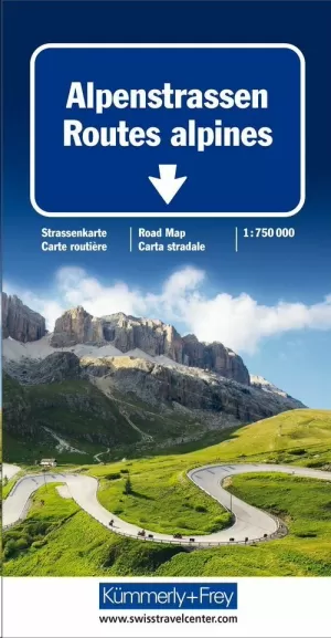
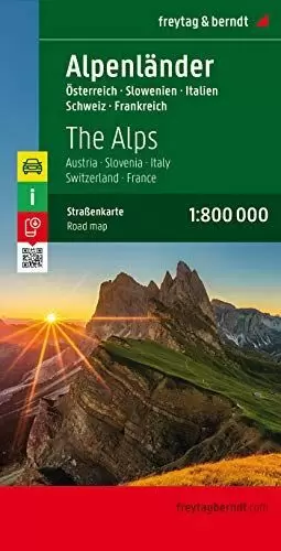
As far as mountains go, Mont Blanc in France and Italy, forming the border between the two countries, with Switzerland nearby, is the best known and most attractive mountain in the Alps. The peak itself is far too challenging for most climbers to attempt, but the region is dotted with ski lifts, hiking trails in the lower regions, and fascinating scenic villages. Mont Blanc tops out at 4,807.81 metres and is protected by Monte Bianco National Park in Italy. There is a long tunnel underneath the mountain joining France (near Chamonix) and Italy (near Courmayeur) and a beautiful highway along its western side (the D1506) and in Italy along its south side (SS26). There is also a Grande Route long-distance hiking trail that surrounds the mountain. We show it in its entirety, including numerous overnight stopping areas, either in towns or in mountain refuges. Naturally, skiing is a huge draw, and we include several ski lifts, all rail lines in the region, including the fabulous cog line from Chamonix to the Grotte de Glace. The Grande Route trail also passes through Switzerland, and we note numerous places to stay in Champex-Lac and La Fouly. The map also includes La Thuile, in Italy, with its many hotels, and touches the nearby French resort town of Sixt-Fer-a-Cheval, a name that should entice anyone to go and visit. The second side of the map is just as interesting, covering the Alps from Geneva to Zagreb, providing drivers with comprehensive coverage of all highways and secondary routes. Rail routes are also emphasized. Given its grandiose scale, touristic points are limited to the most important, but numerous camping sites are noted, as well as all towns and border crossings, notably with Switzerland. The map has two covers, one favouring Mont Blanc and one oriented to the Alps themselves, providing opportunities to market this interesting title to two markets.
Map size: 27*39"