- Editorial:
- CICERONE
- Año de edición:
- 2017
- Materia:
- Guies i mapes excursionisme eslovàquia
- Idioma:
- English
- ISBN:
- 978-1-85284-887-3
- Páginas:
- 336
THE HIGH TATRAS SLOVAKIA AND POLAND
INCLUDING THE WESTERN TATRAS AND WHITE TATRAS
SAUNDERS, COLIN / NÁROZNÁ, RENÁTA
With breathtaking scenery, some 600km of well-maintained, waymarked paths and a selection of characterful resorts, the Tatras mountains have all the elements of a perfect walking holiday. Straddling the border between Slovakia and Poland, the region boasts stunning mountain landscapes: rocky pinnacles, craggy peaks, jagged ridges and towering cliffs, mirror-surfaced tarns and dancing waterfalls.
This comprehensive guidebook contains all the information you need to plan a successful trip to the Tatras. Covering the Western, High and White Tatras, and both sides of the Polish-Slovakian border, it presents a selection of graded route suggestions (both circular and linear and from easy to strenuous) linking the main resorts with peaks, lakes and mountain chalets. In Poland, there is just one base delightful Zakopane whereas in Slovakia, you can walk from several villages strung out along the foot of the range and linked by a tramway. The guide also includes a wealth of information about local services, facilities and attractions and extensive practical advice covering travel and insurance, accommodation and facilities, mountain guides, languages and safety in the mountains.
The Tatras have been designated as a UNESCO World Biosphere Reserve in recognition of their rich biodiversity and the guide presents a summary of the region's plants and wildlife, as well as its fascinating history. Other highlights include an ascent of Kriván, the national symbol of Slovakia, glorious ridge walks in the Western Tatras and gentler strolls taking in caves and waterfalls. Blending information with inspiration, this book is a must for anyone wishing to visit the High Tatras.
Activities
walking
Seasons
July-end August warmest (with thunderstorms); Sept-mid October best walking weather; March-early June not recommended
Centres
Slovakia - Poprad, Stary Smokovec, Tatranska Lomnica, Strbske Pleso; Poland- Zakopane
Difficulty
high mountain walking (up to 2654m); well-engineered, waymarked paths; some scrambling, exposure, use of fixed wires but very wide choice of routes
Must See
flowers and wildlife; staying in a refuge/chalet; historic mountain villages; alpine scenery (the ranges are national parks)
Preface
1 AN INTRODUCTION TO THE TATRAS
Background
Early history
Vegetation and wildlife
Weather
National parks
Languages
Place names
Border controls
2 PREPARATION FOR WALKING
When to go
Obtaining information
Travel and insurance
Accommodation
Fitness
Clothing and equipment
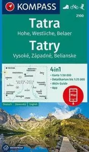
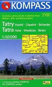
Maps
Paths and waymarking
Refreshments and toilets
Mountain chalets or refuges
Mountain guides
Mountain safety and emergency services
Winter walking
Cross-border walking
Mountain photography
How to use this guide
Grading of walks
3 THE SLOVAK HIGH AND WHITE TATRAS
Later history
Walking
Tatranská Bora
Route suggestions
Waymarked network
With a guide
Path descriptions
Cesta Slobody
Red routes
Tatranská Magistrála
Blue routes
Green routes
Yellow routes
Selected timings
Highest summits
Travel
Diversions
Shopping and local services
Other useful information
Gazetteer
4 THE POLISH TATRAS
Later history
Walking
Route suggestions
Path descriptions
Red routes
Blue routes
Green routes
Yellow routes
Black routes
Selected timings
Highest summits
Travel
Diversions
Shopping and local services
Other useful information
Gazetteer
Appendix A Glossary
Appendix B Accommodation
Appendix C Useful contacts
Appendix D Suggested kit list
Appendix E The Tatras mountain code and Visitors Charter
Appendix F Help!