
- Editorial:
- GIZIMAP
- Año de edición:
- 2016
- Materia:
- Mapes viatge xina
- Idioma:
- English
- ISBN:
- 978-963-87465-1-1
- Páginas:
- 1
- Encuadernación:
- Mapa plegat
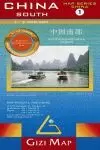
CHINA 1:4.750.000 GEOGRAPHICAL (MAPA GIZIMAP)
MAPA TOPOGRAFIC ESCALA 1:4.750.000 NOMS EN ALFABET XINES I LLATÍ
GIZIMAP
China at 1:4,750,000 on an indexed map from Gizi Maps, showing its topography by bright altitude coloring, road and rail networks, etc. Administrative boundaries are marked and also presented on a separate inset.
The map shows the countrys topography by bright altitude colouring plus graphics to show swamps, deserts, etc, and names of various mountain ranges, peaks, etc. All place names are shown transliterated into Latin alphabet, but with names of larger towns also given in Chinese. Boundaries of the provinces are clearly marked on the main map and a separate inset presents the administrative division of the country, with province names shown in both scripts.
Road network is graded into five types, with driving distances on main routes. Railway lines are included and main local airports are marked. The map shows the course of the Great Wall of China, prominently highlights UNESCO World Heritage sites, and indicates other places of interest. Latitude and longitude lines are drawn at 3° intervals. The index is on the reverse. Multilingual legend includes English.