
- Editorial:
- CICERONE
- Año de edición:
- 2024
- Materia:
- Guies i mapes excursionisme noruega
- Idioma:
- English
- ISBN:
- 978-1-78631-095-8
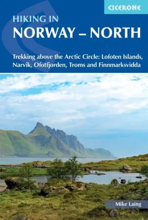
NORWAY - NORTH HIKING
LOFOTEN, NARVIK, OFOTJORDEN, TROMS, FINNMARKSVIDDA
Guidebook to trekking in Norway above the Arctic Circle, including the Lofoten Islands, the mountains around Narvik and Ofotfjord, Tromso and the Troms region, and Finnmarksvidda in the far north east. Treks range from 48 to 165km in length and take between four and ten days to walk. Includes 1:100,000 maps, itineraries and accommodation guide.
Experience the remote beauty of northern Norway with this guidebook to five multi-day hikes above the Arctic Circle. From the dramatic island landscapes of the Lofoten Long Crossing to the open tundra of the Finnmarksvidda, these trails showcase the mountains, fjords, and wilderness that define the northernmost reaches of Europe. Hike across rugged peaks, follow reindeer migration routes, and explore wild landscapes that are at their best in the brief subarctic summer.
Suitable for experienced hikers and backpackers with good fitness, the routes range from 48165km (30103 miles) and take between 4 and 10 days to complete. The five included treks the Lofoten Long Crossing, the Mountains of Narvik, the Mountains of Ofotfjorden, the Troms Border Trail, and Finnmarksvidda offer a variety of landscapes and challenges, some crossing into Sweden or Finland. Access is straightforward via public transport, with accommodation ranging from DNT huts and campsites to opportunities for wild camping.
Detailed, stage-by-stage descriptions for five multi-day northern Norway hikes, from the Lofoten Long Crossing to Finnmarksvidda
Clear directions supported by 1:100,000 maps for each stage, with 1:500,000 overview maps to help plan multi-day treks
Route summary tables, stage facilities planner, and accommodation listings for DNT huts, campsites and wild-camp locations
Practical information on transport, refreshments, and logistics for accessing remote Norwegian trails by bus or ferry
Alternative itineraries where relevant, allowing flexibility in distance or route for each trek
Advice on planning for conditions, including snow at elevation, brief subarctic summer, and navigation in remote terrain
Downloadable GPX files for all five routes to support digital navigation on GPS devices or smartphones
Plan your northern Norway adventure with confidence and experience the dramatic fjords, mountains, islands, and tundra of Europes Arctic frontier with this essential hiking guidebook.
Hiking in Norway North - Quick Facts
Trail name: Hiking in Norway North
Location: Northern Norway, above the Arctic Circle
Routes included: Lofoten Long Crossing, Mountains of Narvik, Mountains of Ofotfjorden, Troms Border Trail, Finnmarksvidda
Route type: Multi-day mountain and coastal treks
Distance range: 48165km / 30103 miles
Typical duration: 410 days per trek
Route format: Linear routes with opportunities to adjust stages or combine sections
Terrain: Mountains, fjords, tundra, islands, wilderness areas
Difficulty: Challenging suitable for experienced hikers and backpackers with good fitness
Navigation: 1:100,000 maps per stage, 1:500,000 overview maps, downloadable GPX files
Best season: Early June to mid-September for subarctic conditions
Accommodation: DNT huts, official campsites, and options for wild camping
Access: Regular public transport to trailheads, including buses and ferries
Author Highlight
"Welcome to the roof of Europe and the fabled Land of the Midnight Sun. Norway has much to offer the walker and her vast open spaces will delight and enthral in equal measure. The region shares its latitude with Disko Bay in Western Greenland and Canadas Baffin Island yet benefits from relatively mild summers thanks to warming air masses such as the North Atlantic Current. All the trails in this guide sit to the north of the Arctic Circle and you can expect 24-hour daylight for up to eight continuous weeks, from mid May until mid July up in the very north."
- Mike Laing, author of Hiking in Norway - North