- Editorial:
- ITMB
- Any d'edició:
- 2016
- ISBN:
- 978-1-77129-844-5
- Enquadernació:
- Mapa plegat
- Col·lecció:
- PAISES Y REGIONES ITMB
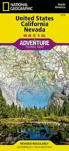
USA WESTERN RAILROADS / HIGHWAYS 1:1.700.000 -ITMB
This is also a new title for ITMB, replacing our former map called USA West Half. This map does not cover the same area exactly, nor is it at the same scale, but more importantly, its purpose has changed. Travel in the USA is changing. The younger generation is increasingly travelling by train and bus to get from place to place, as airfares rise and the cost of a car becomes more expensive. At first, we thought of doing an AMTRAK/VIA Rail map of North America, but the resultant scale would have reduced detail to an unacceptable level, so we opted to convert the concept of a map of half a country into a map thematically attempting to concentrate on travel by rail around at least a large portion of America. The motorways, highways, and touristic attractions are still shown, but the passenger service rail lines a shown prominently. This is a double-sided north-south map, with side one showing from Vancouver south to Red Bluff in California and east to Casper, Wyoming. The other side covers from north of Sacramento, California to the Mexican border and from the Pacific shore east to Denver or El Paso. This covers a goodly portion of the USA at a better scale than our previous edition, with the same attention to touristic detail as one the earlier map.
Map size: 27*39"
This map is also available in digital format for $39.95 (per file) and flat map for $39.95 (per side). Please contact map@itmb.com if you would want to place an order or for more information.
Legend Includes:
Roads by classification, Railways, Airports,Elevation range, World Heritage Sites, Natural Reserves, Viewpoints, Museums, Information Centers, Gas stations, Hotels, Waterfalls and much more.